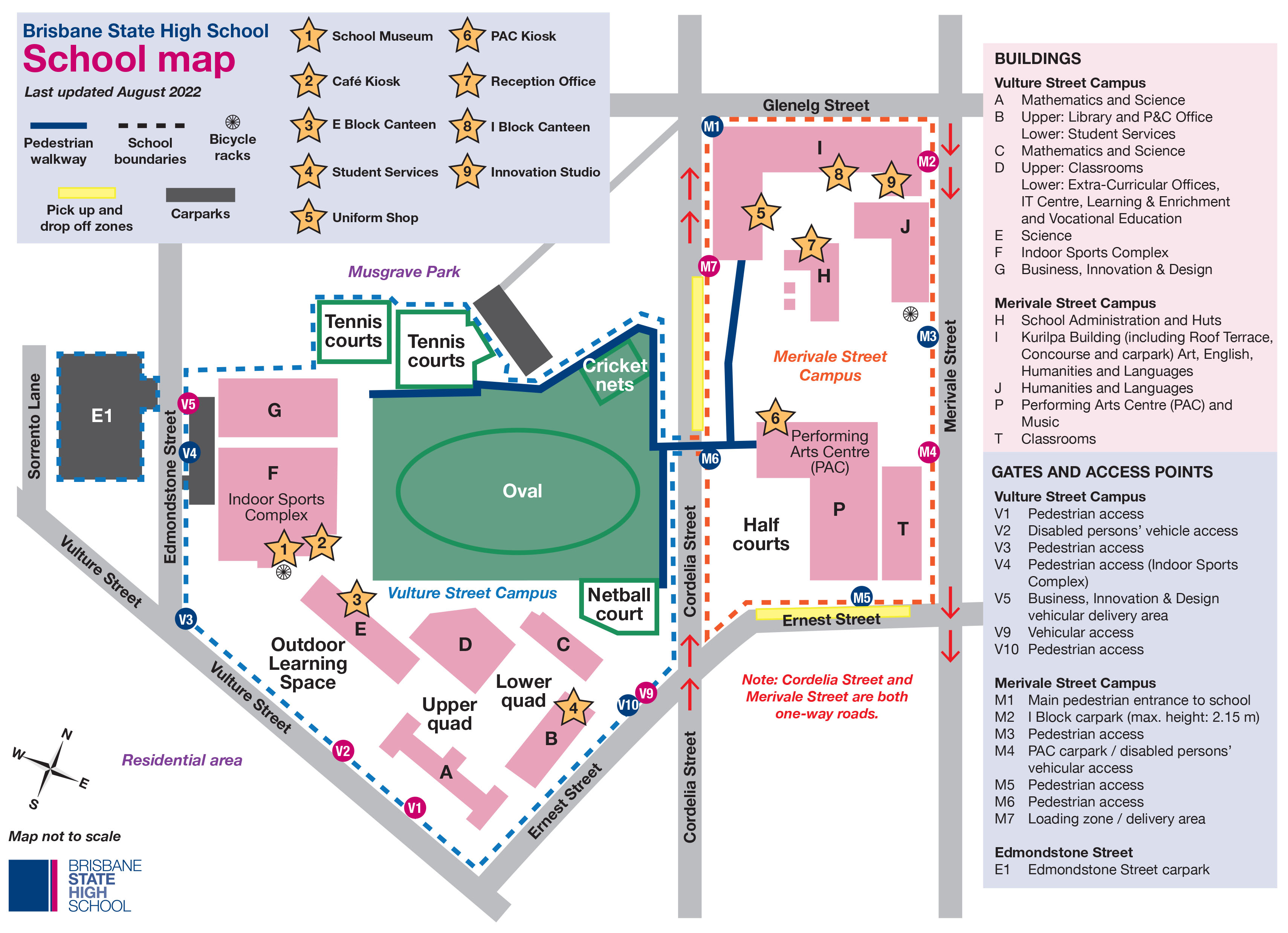
School map
Please see below for a map of Brisbane State High School.
The School Map is available for download – School Map (PDF 217KB).
The Fursden Road Playing Fields map is also available for download – Fursden Road Playing Fields Map (PDF, 518KB).
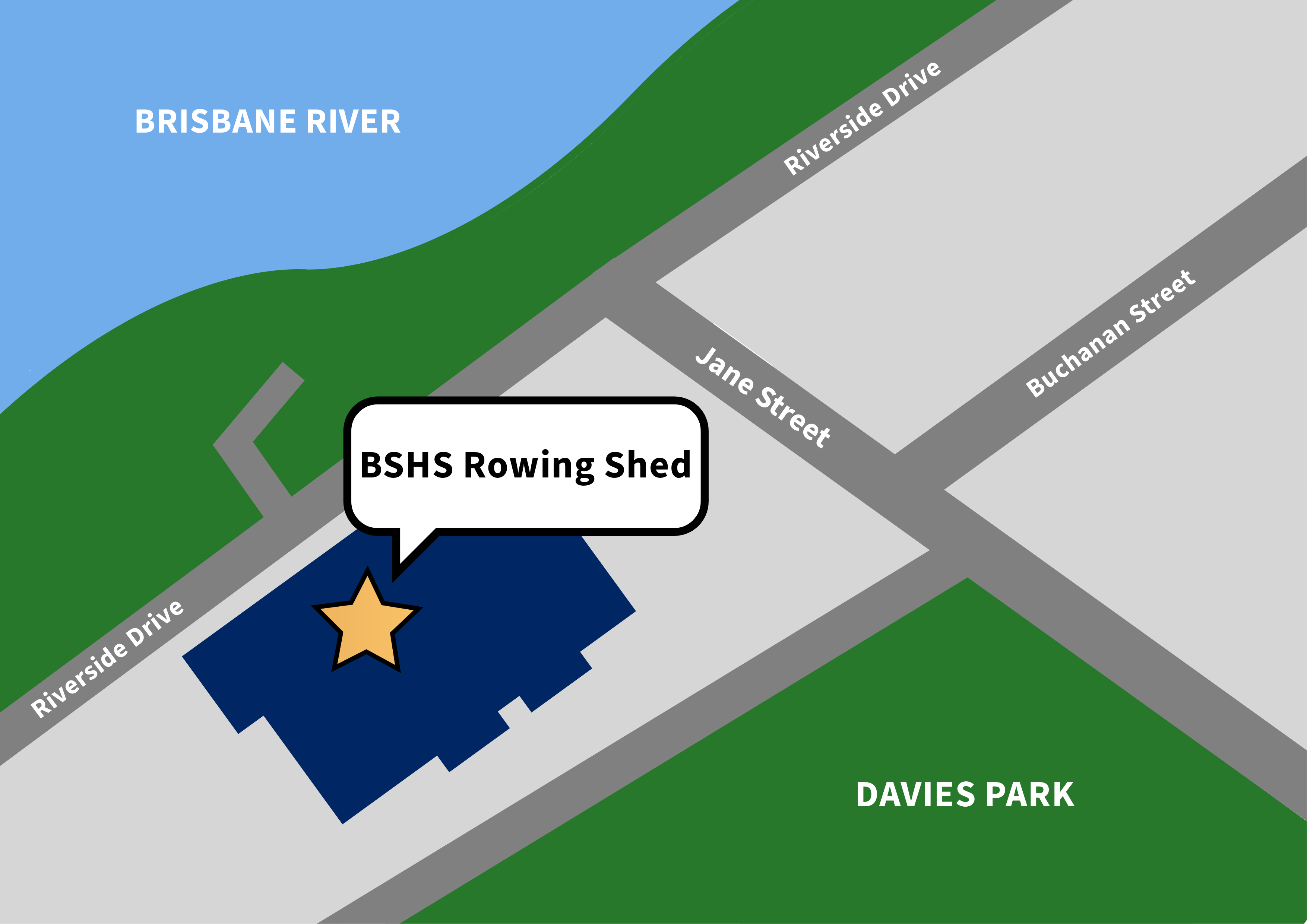
The BSHS Rowing Shed is located at 150 Jane Street, West End.
Travelling to and from school
Public transport
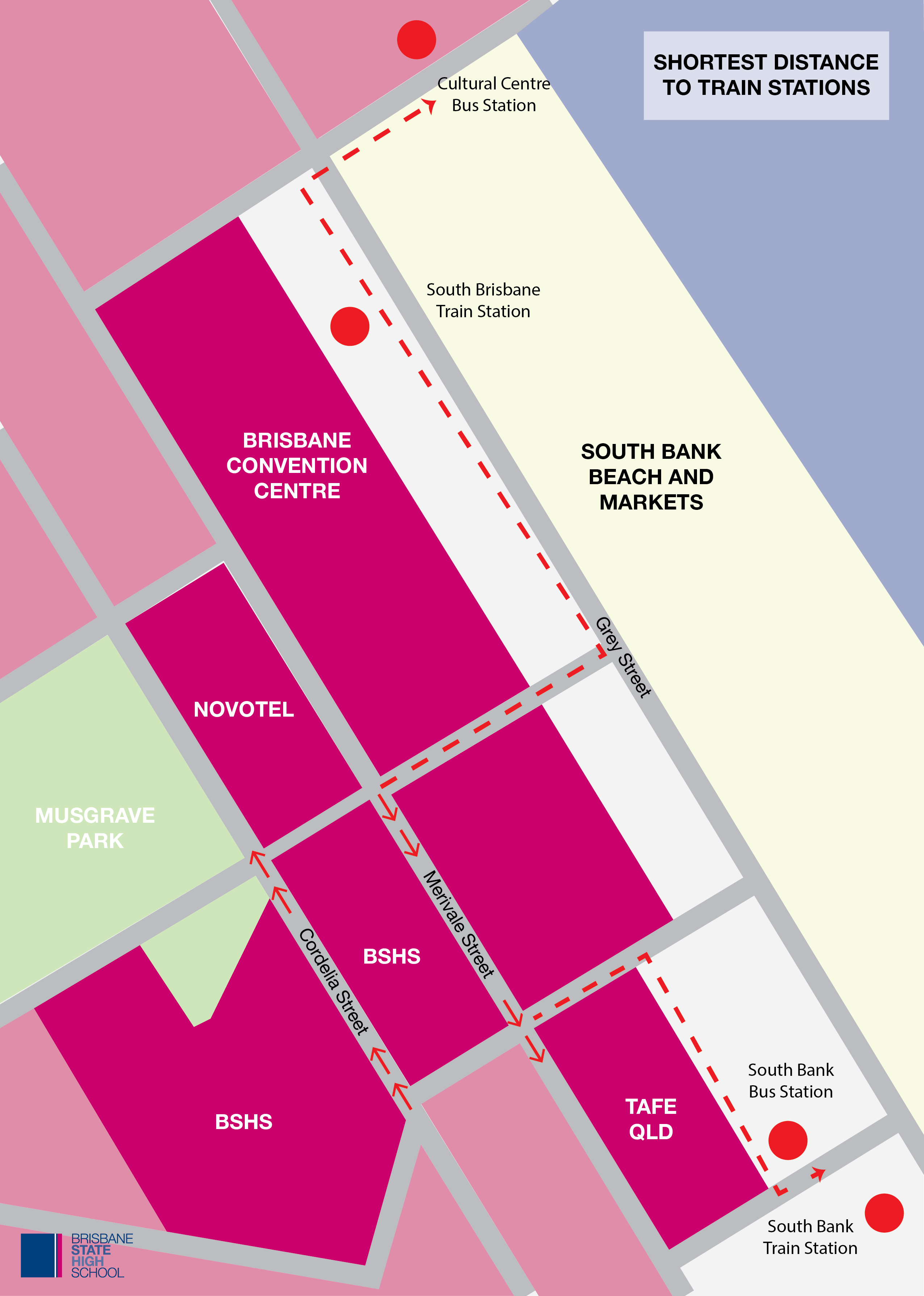
We have excellent access to bus and train services. The nearest stations for both bus and rail are at South Bank. Students also use the Cultural Centre Station which is in walking distance.
You can find out about buses and trains to and from school using the Translink Journey Planner.
Walking
We encourage our students to walk to school, where that is possible.
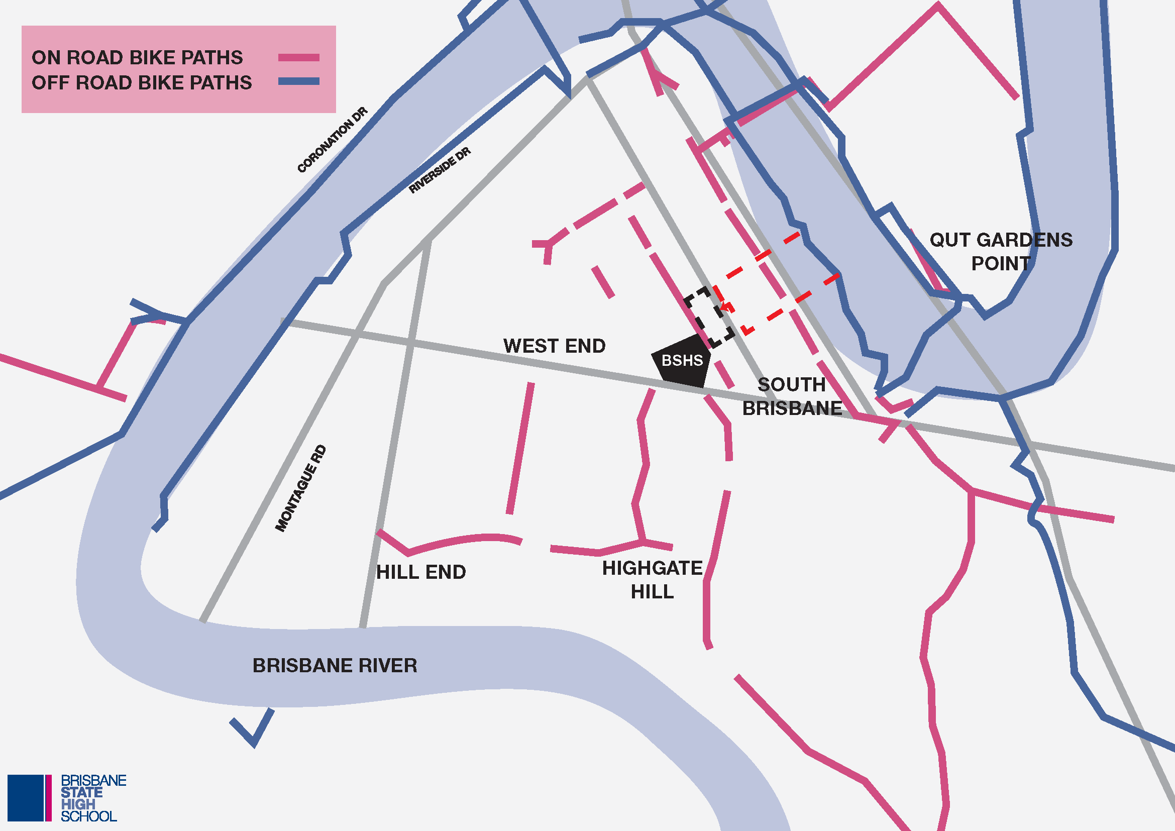
Bicycle
Students are encouraged to use active transport.
For students who ride to school, bike racks are located at the Vulture Street and Merivale Street entrances. Students are responsible for locking bikes securely to avoid theft.
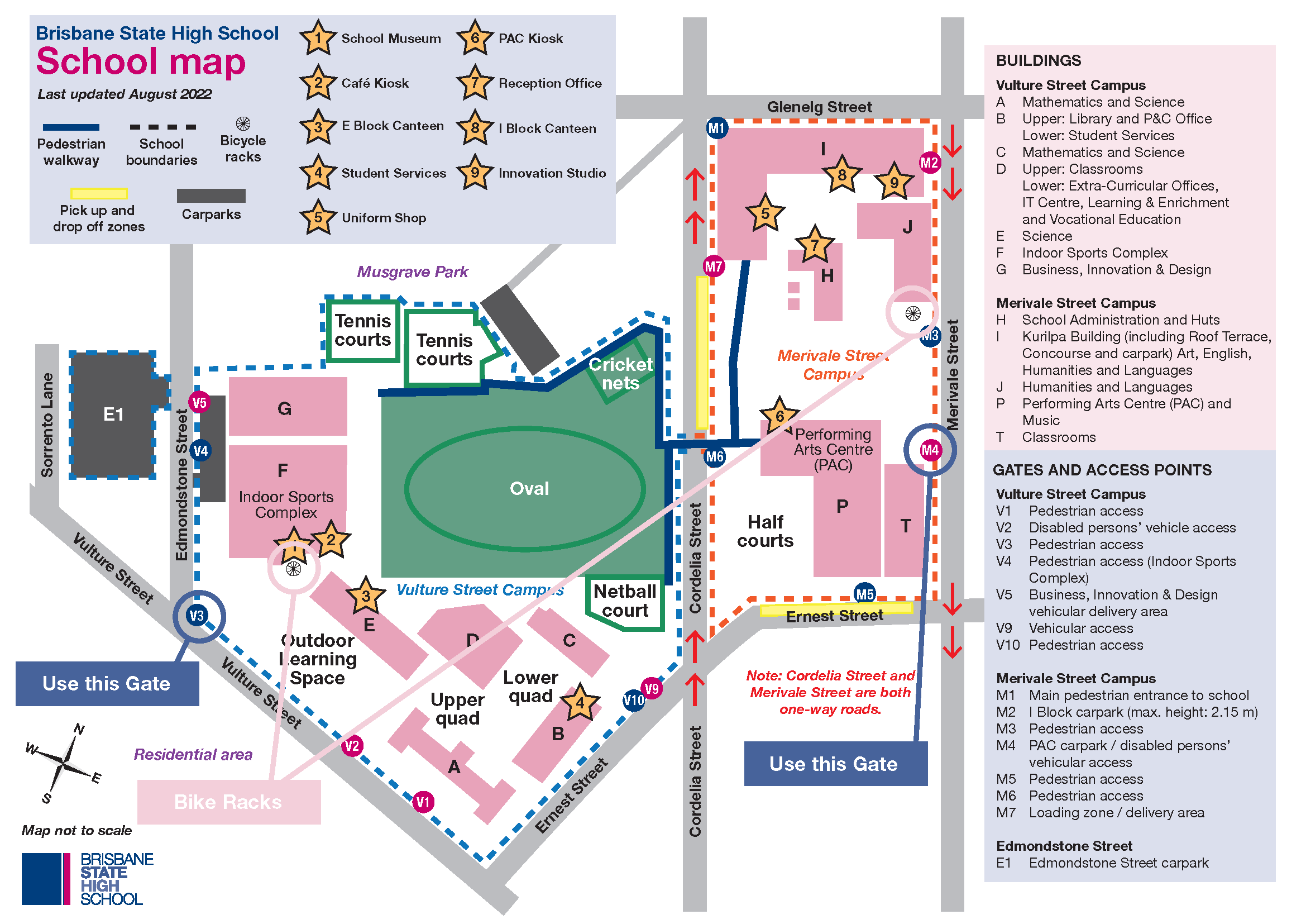
There are a number of bike tracks near the school that limit the need to ride on the street for long distances. From South Bank itself, it is a short distance along Glenelg or Ernest Streets to Gate M4 which has good access to bicycle racks.
We encourage parents to map out the least congested routes to school, with their students, to ensure safety.
Motor Vehicles
There are passenger drop off/pick up zones around the school. These standing zones are strictly limited to 2 minutes. This is enforced by police and the Brisbane City Council.
The drop off zones have limited capacity. Parents should note that it is both illegal and dangerous to queue onto the road. The law says that you must circle the block and return to the queue once there is room.
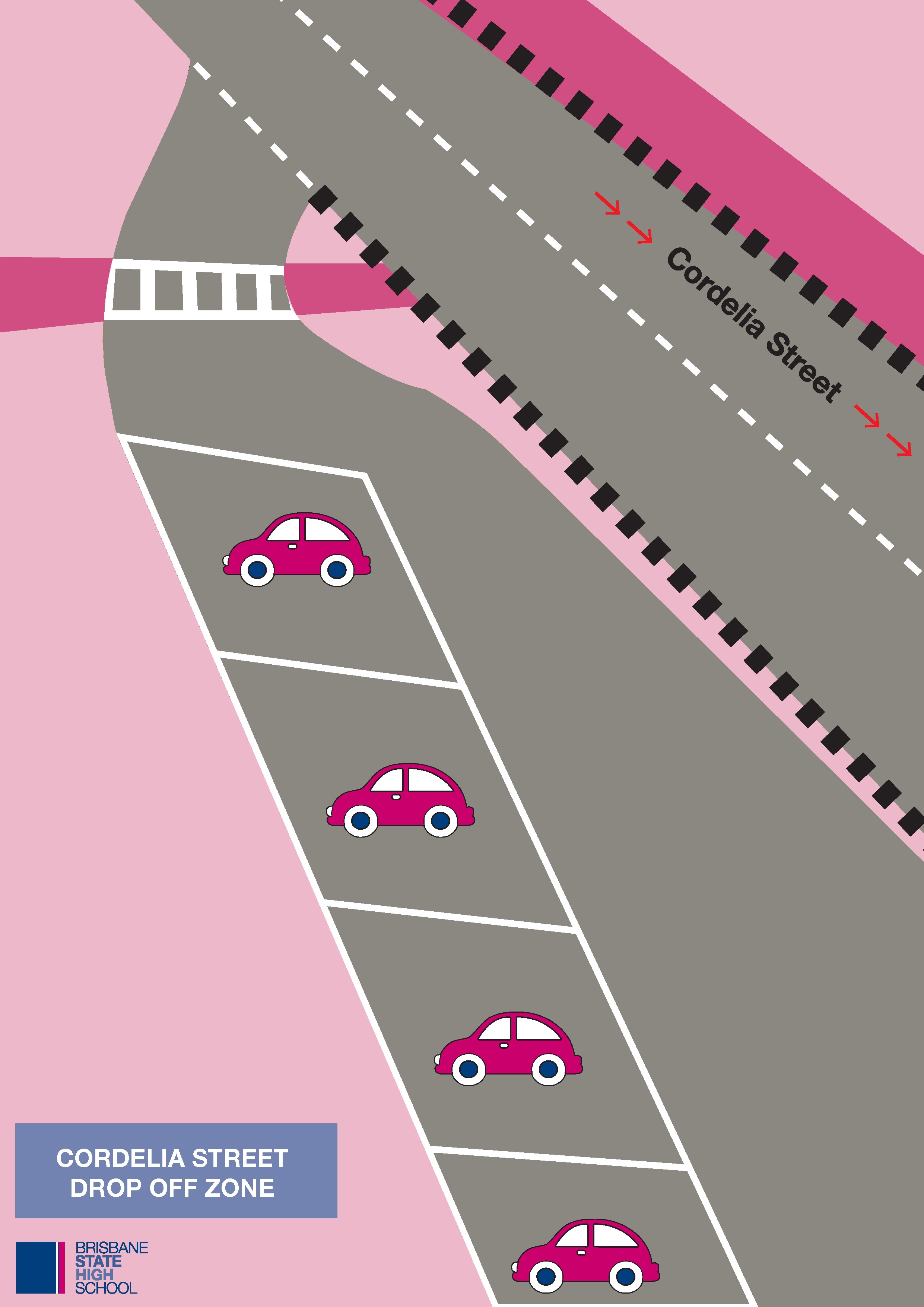
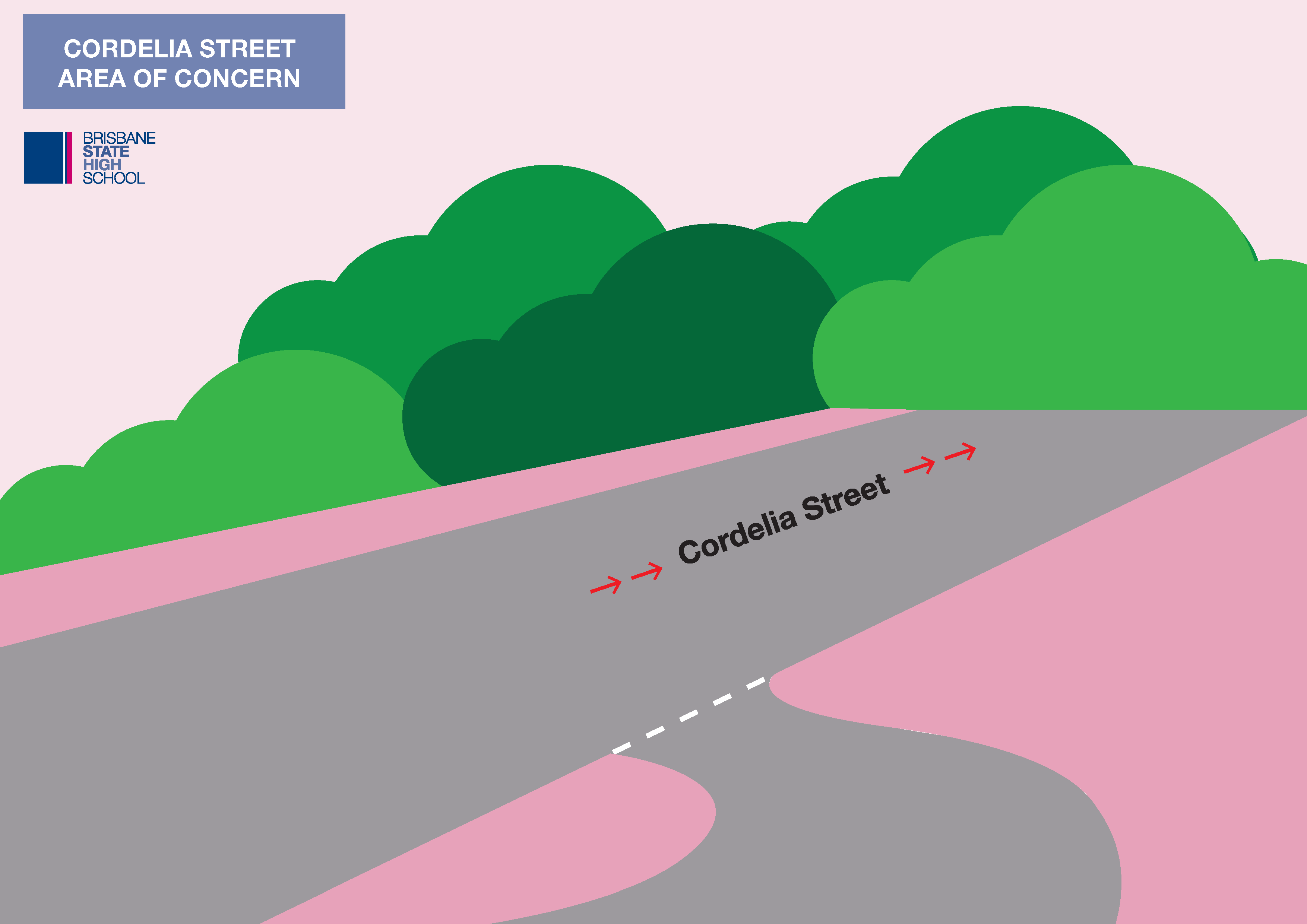
The drop off zone on Cordelia Street requires caution to ensure safety and is best used by students who have large equipment to bring to school. When exiting this drop off zone, you will need to carefully position your vehicle to ensure you can see all three lanes of traffic.
We encourage parents to negotiate alternate drop off and pick up areas with students. This alleviates congestion and a short walk is good for the students. Consider adjacent streets, the end of Musgrave Park and other areas for speedier access.
Student Vehicles
We discourage students from driving to school because of the lack of parking. Students are not permitted to leave school during the day to extend parking times.
Students who do drive to school are discouraged from having passengers, except family members. Where passengers are carried, prior parent consent should be sought.
Parking
Parking is not available at Brisbane State High School.
There is only limited parking around the school — 2 hour restrictions apply. Download Brisbane City Council’s regulated parking zone map (PDF, 672 KB) to find out more about parking limitations around the school.
Paid parking is available through: